Drone Scotland and LiDAR
Choosing the right partner is as important as choosing the right technology.
Since our establishment, Drone Scotland has been at the forefront of aerial data capture. We have been conducting LiDAR surveys for over 7 years. We supply to clients across many industries, including Construction, Housebuilding, Renewable Energy, and Environmental and Conservation Management. Our team travels across the UK to deliver LiDAR surveys for our clients.
Our Commitment to Quality:
- Experience Matters: Our 7+ years of specialisation mean we understand the nuances of Scottish terrain and the specific demands of regulatory bodies and project managers.
- Advanced Hardware: We utilise the latest high-end, calibration-free LiDAR sensors, ensuring the highest data quality and density for every survey.
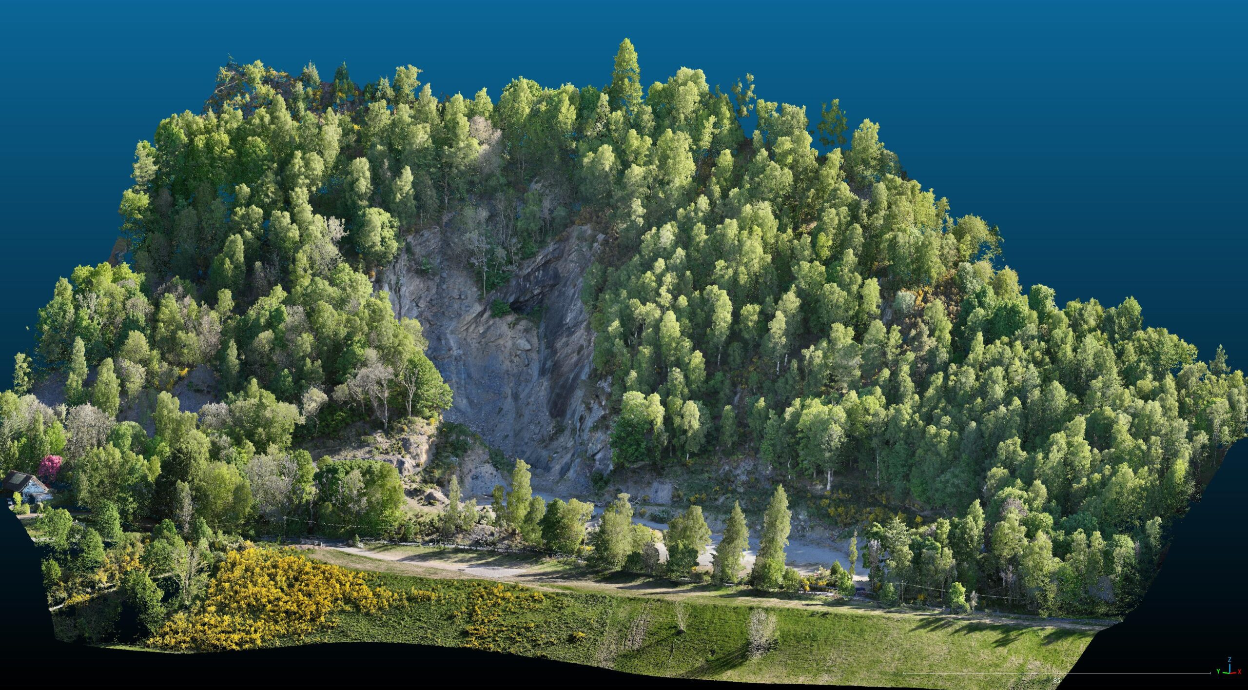
- Expert Processing: Data processing is where the magic happens. We don’t just fly the mission; our in-house specialists meticulously clean, classify, and colourise the raw point cloud data to deliver final outputs in the exact format required for your CAD, BIM, or GIS software.
- End-to-End Service: From initial consultation and flight planning to data acquisition, processing, and final delivery, we manage the entire workflow, ensuring seamless, reliable results every time.
What is LiDAR?
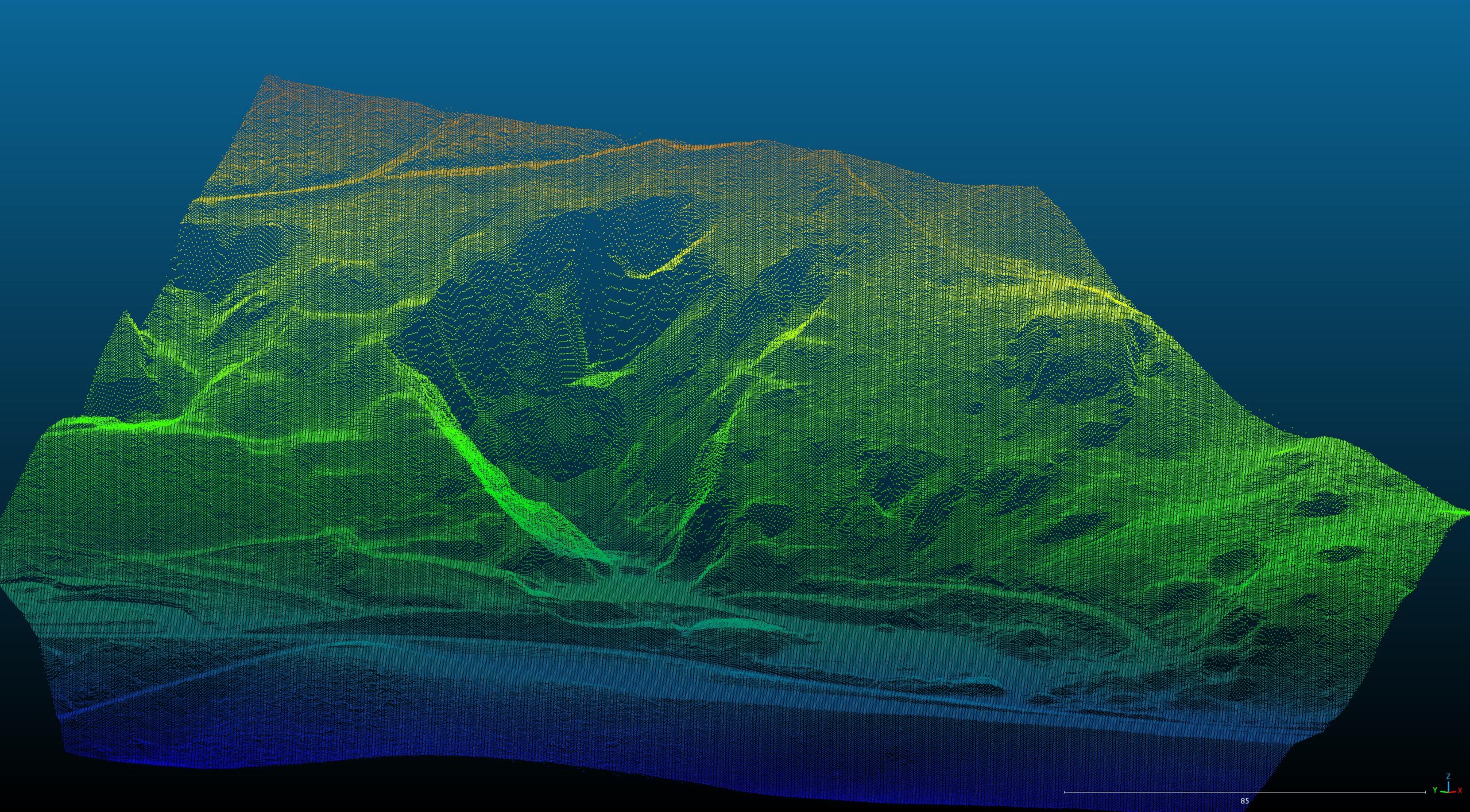
LiDAR (Light Detection and Ranging) is a remote sensing method that uses pulsed laser light to measure ranges (variable distances) to the Earth. These light pulses—combined with other data recorded by the airborne system—generate precise, three-dimensional information about the shape of the Earth and its surface characteristics.
Essentially, a drone-mounted LiDAR sensor fires hundreds of thousands of laser pulses per second at the ground. By measuring the time it takes for each pulse to return, the system calculates the exact distance. This process creates a massive, highly accurate dataset known as a point cloud. This is a digital representation of the surveyed area.
Benefits of LiDAR
LiDAR technology offers significant advantages over traditional surveying and photogrammetry methods, particularly for large or complex terrain:
- Exceptional Accuracy and Precision: LiDAR delivers centimetre-level positional accuracy. This makes it the gold standard for engineering, construction, and detailed topographical mapping.
- Rapid Data Capture: Drones can survey vast areas quickly, dramatically reducing project timelines compared to ground-based methods.
- Vegetation Penetration: A major advantage of LiDAR is its ability to penetrate gaps in vegetation (like tree canopy). While photogrammetry captures the top of the canopy, LiDAR’s multiple returns capture data points on the true ground surface below. This is crucial for accurate Digital Terrain Models (DTMs).
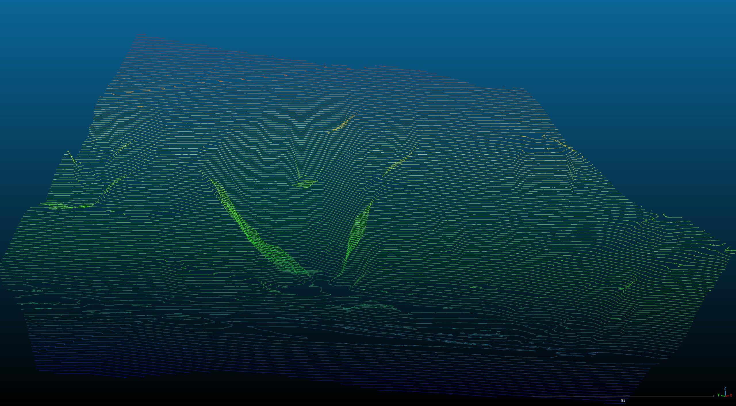
- Direct 3D Modelling: The resulting point clouds are inherently 3D, allowing for the immediate creation of detailed Digital Elevation Models (DEMs), Digital Surface Models (DSMs), and volume calculations.
- Efficiency in Low Light: LiDAR uses its own light source (the laser). This operates effectively in low-light conditions, though daylight is still preferred for operational safety.
Expectations and Limitations of LiDAR
To ensure successful project outcomes, it is important to understand what LiDAR can and cannot do:
| Expectation | Limitation |
| Highly Accurate Ground Model: You will receive a DTM that represents the ground even under moderate vegetation. | Cannot Penetrate Dense Materials: LiDAR cannot penetrate thick materials like water, heavy snow, or dense roofs. |
| Fast Turnaround for Large Areas: Significant site coverage can be achieved in a single day. | Sensitive to Weather: Heavy rain, fog, and low clouds can interfere with the laser pulses and should be avoided. |
| Dense, Classified Point Cloud: The output is a rich dataset (millions of points) with features (ground, buildings, vegetation) categorised. | Data File Size: Point cloud files are very large and require suitable computing power and software to handle and process. |
| High Resolution for Detailed Inspections: Useful for infrastructure monitoring and volume calculations. | Colour Data is Secondary: While point clouds can be colourised using a simultaneous photogrammetry camera, the primary data (geometry) comes from the laser, not the image. |
When is the best time to conduct LiDAR?
While a LiDAR survey can be executed year-round, the best time is often determined by the specific requirements of the project and the local environment.
- Leaf-Off Season: For achieving the most accurate and detailed Digital Terrain Model (DTM), the winter or early spring (when deciduous trees have shed their leaves) is often ideal. The absence of foliage allows the laser pulses maximum penetration to the bare earth, reducing noise and improving ground classification.
- Clear, Dry Conditions: Regardless of the season, all aerial surveys benefit from clear skies, low winds, and dry weather. Moisture in the air (fog, heavy rain) can scatter the laser light, diminishing data quality.
- Specific Project Timelines: For construction or engineering projects, the “best time” is often tied to key project milestones or necessary deadlines. Our fast deployment capability ensures we can mobilise when your project demands it.
Get in touch
For more information on our LiDAR Services and pricing then contact the team on 0141 302 4685 or office@dronescotland.com