Drone Scotland offer advanced Thermal Surveys to clients across numerous sectors in the UK including commercial property, public sector, residential, and solar energy. We utilise state-of-the-art thermal imaging technology to assess building performance, identify energy inefficiencies, and detect structural issues.

Outputs of thermal imaging
- Accurate Detection of Heat Loss and Insulation Issues
- Identify water ingress – Thermal imaging is highly effective in detecting moisture infiltration, which can lead to mold growth and structural damage. By identifying wet areas early, Norelo help prevent costly repairs and maintain a healthy indoor environment.
- Provide evidence for dispute resolution
- Assess air tightness
- Inspect roofs
- Support hand over documentation
- Inspect solar panels
Our thermal surveys provide detailed insights into heat loss, moisture, and other critical factors that impact the health and efficiency of buildings. This non-invasive and precise method can be used in domestic and commercial buildings. Traditional thermal imagery methods can be both time consuming and costly. In comparison, UAV’s can quickly cover large surface and access hard to reach areas without using expensive or high risk methods such as cherry pickers or scaffolding.
APPLICATION OF A THERMAL IMAGING SURVEY
- Commercial and Industrial Facilities Our thermal imaging can identify operational inefficiencies such as overheating machinery or inadequate insulation. This helps businesses reduce operational costs, optimise their energy use and comply with safety regulations.
- Historic and Heritage Buildings Drone Scotland conduct thermal surveys for assessing the condition of the buildings without invasive methods.
- Residential Buildings For homeowners, thermal surveys provide a detailed analysis of a property’s energy performance, helping to identify areas for improvement.
- Building Inspections and Maintenance Regular thermal surveys are an essential part of proactive building maintenance. By detecting issues early our thermal surveys allow you to avoid more extensive damage and associated costs.
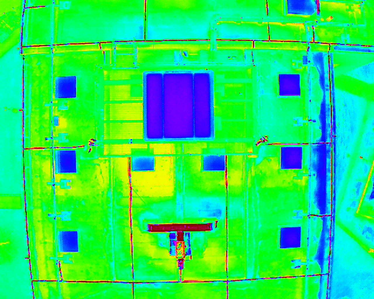
We deploy technology that can enable us to measure surface temperatures to within 5% accuracy. Our ground station control read out can measure specific temperatures of any visible object. It can also provide targeted information relating to the maximum temperature, minimum temperature and average temperature.
The system can be set to trigger an alert should a pre-defined temperature be detected by our FLIR system. All of this is displayed with a 640 by 480 resolution.
The measurable temperature ranges can be defined should there be a need for a targeted and highly sensitive inspection.
At Drone Scotland we utilise a fleet of Drones for surveys. For Thermal surveys we deploy the DJI Mavic 3T drone.
There are many benefits of the application of Thermal Imaging surveys. To find out more contact our team at office@dronescotland.com or 0141 302 4685.