
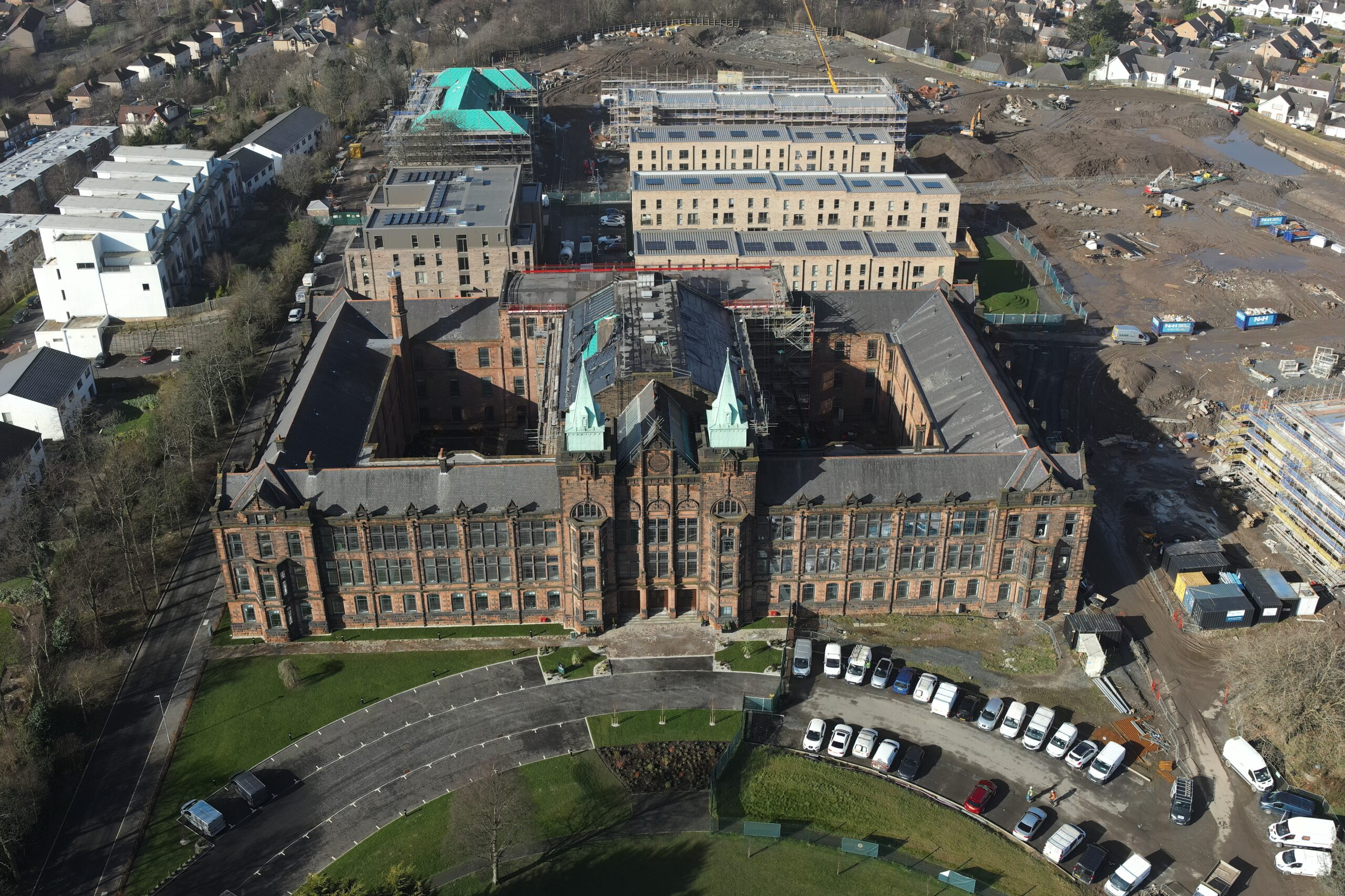
Ok, so you have decided that you require a drone survey. What are the next steps you have to take? Who do you choose to instruct? What due diligence should you undertake? Whether your drone survey takes place in Glasgow, Edinburgh, London or Birmingham, the research and planning are the same.
Firstly, let me welcome you into the world of drones/UAV’s/UA’s/SUA’s and the long list of other terms to described remotely piloted aircraft systems. The latter, being referred to as RPAS. Drone technology is revolutionising everyday tasks. Not only is it safe, environmentally sound and efficient, it also provides unrivalled access to information that helps you make timely and accurate decisions.
The industry is, however, still very fragmented and everyone knows someone that has a drone and everyone knows about the time that person flew into a tree. With thousands of operators, how do you know who to choose to capture your drone survey?
Questions to ask your drone surveyor
1. Do they have relevant drone survey experience?
The first place to look is if they have a website. Any tech driven business, which the drone industry is, will have a website. A company with depth will have a website that reflects that depth which is unlikely to be a single page post. Within this website you ought to be able to ascertain experience, skill sets and details of similar work to the project you are trying to complete.
The word ‘survey’ is quite broad and a drone survey can come in many guises. These are most likely to be one of the following:
- building inspection/condition survey
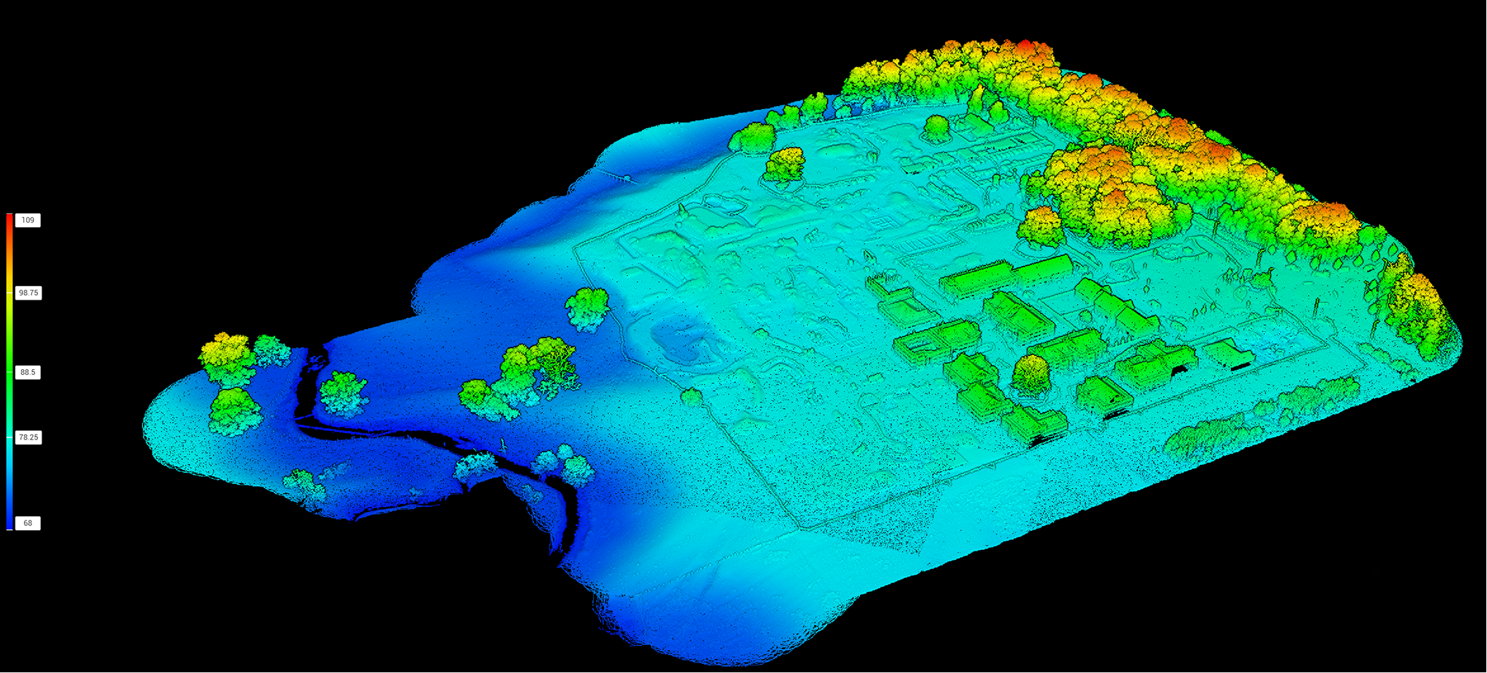
- land survey/topographical survey
- measured building survey
- video/imagery
- thermal survey
Experience in the correct type of survey is essential as a building survey can range from low resolution imagery to high resolution imagery built into a fully interactive 3D model. Land surveys can be simple maps through to highly precise outputs aligned to OSGB 1936 or other grid systems. Thermal surveys can show variances in temperature or can be properly calibrated to show actual temperatures. Which you require is down to the requirements of the task and your budget. The price will also vary subject to the final deliverables. Ask for examples and ask the drone survey company to talk you through the options as well as the deliverables. Sometimes you may simply need images and in other instances, you may require a more comprehensive output.
2. Who is writing the final drone survey report?
Identify whether your drone survey company will be instructing a chartered surveyor to conduct the survey or not. the person capturing the data doesn’t need to be a chartered surveyor but the deliverables may need a chartered surveyor to write the final report. Always best checking as not everyone is forthcoming with this detail. At Drone Scotland, we are data acquisition experts. We are not chartered surveyors. We always make this point perfectly clear. Our data is often passed to chartered surveyors and thus we price accordingly.
3. Is your drone pilot capable of delivering the survey legally?
Any drone survey in Glasgow needs to be conducted by a person or company with a valid operational authorisation from the Civil Aviation Authority and must have commercial public liability insurance. If they don’t they cant operate their drone legally*. You should always request a copy of their operational authorisation, insurance documentation, operator ID and flyer ID. Make sure you get all four. If in doubt you can verify their authenticity by contacting the CAA Check someone’s registration status | UK Civil Aviation Authority.
Every CAA approved operator will have pre-defined environmental conditions in which they can operate. The key condition is the minimum separation from uninvolved people. An uninvolved person is regarded as a person not directly involved in the survey. Thus, the general public are all classed as uninvolved. To avoid doubt, this is normally no closer than 30m during take off and 50m once airborne. If the operator has an operational authorisation (OA) they can fly to these distances and distance is regarded as a bubble round the drone. Thus as the drone gains height, the horizontal separation reduced. Overflight of uninvolved people should be minimised and overflight of crowds (assemblies of people) is illegal.
Operators with A2CofC qualification or less cannot operate in this manner and must always maintain minimal separation of 50m from uninvolved people irrespective of drone height. Operators that don’t have an A2CofC qualification must maintain a minimum horizontal separation of 150m from uninvolved people*. (More information on this can be sourced from the CAA)

50m = length of an Olympic swimming pool
As the land owner or manager you also hold accountability of the actions of the drone operator. Article 241 of the air navigation order 2016 states ‘A person must not recklessly or negligently cause or permit an aircraft to endanger any person or property.’ Thus, you must not permit reckless or negligent flights from your land. Avoid this by appointing an operator with the correct qualifications, experience, equipment, insurance and one that can provide full RAMS for the work being undertaken. The RAMS should be site specific and include flight and site assessments.
4. What permissions does your drone surveyor have?
There are a few companies in the UK that carry specialist permissions to operate in more challenging conditions. less than 0.05% of operators can do so, and Drone Scotland is one of such companies. We can operate as close to within 5m of uninvolved persons during take off and our separation during the operation can be as small as 20m (rather than the 50m/150m of less qualified operators). Permissions are widely known as operational safety cases (OSC). Companies such as Drone Scotland have demonstrated to the CAA that their operational procedures, safety records, and experience warrant the privilege to fly where over 99.95% can’t.
5. Does your drone surveyor understand the airspace?
Another important consideration is the airspace. A qualified and experienced operator will handle this as part of their flight planning. Lets focus on the obvious points – no flying near airports or prisons without the correct permissions. Doing so could lead to prosecution.
As you can see from all of the above, there is a lot to take into consideration. With the correct help and guidance, it’s actually reasonably straight forward to plan your Drone survey in Glasgow. Or for that fact, in any major city. Need more advice from a straight talking professional aerial data supplier? Call us on 0141 302 4685 or email us at office@dronescotland.com
*Certain smaller recreational drones can be flown without a permission from the CAA. These drones weigh below 250g. The Pilot still needs commercial insurance for commercial work – even if not being physically paid. Although no minimal separation is currently required for these drones the pilot must not fly in a dangerous manner. The landowner/manager must also not let them fly in a dangerous manner. Article 241 of the air navigation order 2016 ‘A person must not recklessly or negligently cause or permit an aircraft to endanger any person or property.’
Drone Scotland Surveys – 0141 302 4685 office@dronescotland.com