


At Drone Scotland, we deliver survey-grade geospatial data using the DJI Zenmuse L3—the industry’s leading high-precision aerial LiDAR payload. Mounted on our heavy-lift enterprise fleet, the L3 system allows us to generate sub-centimeter digital terrain models, penetrating dense canopy and complex structures where traditional photogrammetry falls short.
Whether you require bare-earth terrain models for civil engineering, structural corridor mapping for utilities, or volumetric analysis for quarrying, our LiDAR surveys provide unmatched speed, accuracy, and detail across Scotland.
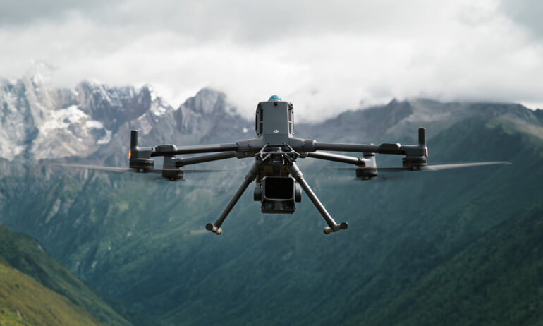
What Sets the Zenmuse L3 LiDAR Apart?
Unlike optical cameras that rely on visible light, the Zenmuse L3 emits active, eye-safe 1535 nm laser pulses (emitting up to 2,000,000 points per second) to penetrate physical barriers and measure ground elevation directly.
Key Performance Capabilities
- Survey-Grade Accuracy: Delivers vertical accuracy of 3 cm (RMSE) and horizontal accuracy of 4 cm at typical flight altitudes, meeting stringent UK civil engineering tolerances.
- Superior Canopy Penetration: With up to 16 returns per pulse and an ultra-narrow 0.25 mrad beam divergence, the laser easily pierces through forest canopies, dense gorse, and scrub to map true ground level (Bare Earth DEMs).
- Extended Reach & Efficiency: Capable of detecting targets up to 950 meters away, allowing our crews to safely survey steep Highland glens, deep quarries, and active infrastructure from a safe altitude.
- Dual 100 MP Photogrammetry System: Features a dual 100-megapixel RGB camera array. In a single flight pass, we capture simultaneous high-density LiDAR point clouds and ultra-high-resolution true-color imagery to produce fully photorealistic 3D point clouds and 2D orthomosaics.
Core Benefits of Drone Scotland LiDAR Surveys
1. True “Bare Earth” Elevation Models
Photogrammetry (standard aerial photography) measures the top of grass, trees, and buildings. The Zenmuse L3’s multi-return laser pulses pass between leaves and branches to hit the ground below, allowing us to strip away vegetation digitally and reveal the underlying terrain.
2. Significant Safety & Time Savings
Surveying hazardous, steep, or unstable sites (such as active quarries, peatland restoration sites, or railway cuttings) on foot poses significant health and safety risks. Our L3 drone surveys capture hundreds of hectares per day safely from above, eliminating the need for ground personnel in dangerous zones.
3. Penetration of Shadow & Low Light
Because LiDAR is an active sensing technology (it carries its own light source via the laser), our surveys remain 100% accurate under thick cloud cover, deep shadow, or low-light conditions—ensuring your project stays on schedule through Scottish winters.
Target Industry Applications
| Sector | Primary Deliverables & Uses |
| Civil Engineering & AEC | Highly accurate DTMs, contour maps, site elevation profiles, and 3D digital twins for CAD/BIM integration. |
| Forestry & Woodland Management | Precise canopy height modeling (CHM), individual tree counts, biomass estimations, and ground profile mapping under dense tree cover. |
| Utilities & Infrastructure | Powerline sagging analysis, thin-cable wire detection, pipeline corridor mapping, and encroachment monitoring. |
| Quarrying & Mining | Fast, high-accuracy stock pile volumetric calculations and slope stability monitoring without halting active machinery. |
| Environmental & Peatland Restoration | Micro-topography mapping, flood risk modeling, and hydrological flow analysis across delicate Highland ecosystems. |
Survey Deliverables We Provide
We deliver survey data in industry-standard formats ready to import directly into AutoCAD, ArcGIS, QGIS, Civil 3D, or Revit:
- Point Clouds: LAS / LAZ / E57 (Classified by ground, low/medium/high vegetation, and structures)
- Digital Surface Models (DSM) & Digital Terrain Models (DTM): GeoTIFF / DEM
- Topographic Maps: 3D Contours (DXF / DWG)
- High-Res True-Color Orthomosaics: ECW / GeoTIFF
Commission a LiDAR Survey with Drone Scotland
Need accurate, vegetation-penetrating spatial data for your site? Contact our CAA-authorized, fully insured drone surveying team today to discuss your project requirements.
At Drone Scotland, we deliver survey-grade geospatial data using the DJI Zenmuse L3—the industry’s leading high-precision aerial LiDAR payload. Mounted on our heavy-lift enterprise fleet, the L3 system allows us to generate sub-centimeter digital terrain models, penetrating dense canopy and complex structures where traditional photogrammetry falls short.
Whether you require bare-earth terrain models for civil engineering, structural corridor mapping for utilities, or volumetric analysis for quarrying, our LiDAR surveys provide unmatched speed, accuracy, and detail across Scotland.
For more information contact our team at office@dronescotland.com
