When it comes to mapping and surveying, Scotland presents a unique set of challenges. From the dense forestry of the Highlands and overgrown terrain in the Lowlands, to our notoriously unpredictable weather, capturing accurate topographic data has historically been a time-consuming and labor-intensive task.
Enter Drone LiDAR
At Drone Scotland, we are always looking for ways to provide our clients with the highest standard of aerial data. LiDAR technology mounted on modern commercial drones has completely transformed the surveying landscape. But what exactly is it, and how can it benefit your next project? Let’s dive in.

What is Drone LiDAR?
LiDAR is a remote sensing method that uses light in the form of a pulsed laser to measure ranges (variable distances) to the Earth.
When a drone equipped with a LiDAR sensor flies over an area, it fires thousands of laser pulses per second at the ground. The sensor measures how long it takes for each pulse to bounce back. By combining this data with highly precise GPS (GNSS) and an Inertial Measurement Unit (IMU), the system calculates exactly where each point is in 3D space.
The result? A massive, highly accurate collection of points known as a 3D Point Cloud.
LiDAR vs. Photogrammetry: What’s the Difference?
A common question we get is: “Can’t you just use standard drone photography to make maps?” The answer is yes—that process is called photogrammetry. Photogrammetry is fantastic for creating high-resolution visual 3D models and orthomosaics, but it has one major limitation: it cannot see through gaps in vegetation. It relies on line-of-sight visibility.
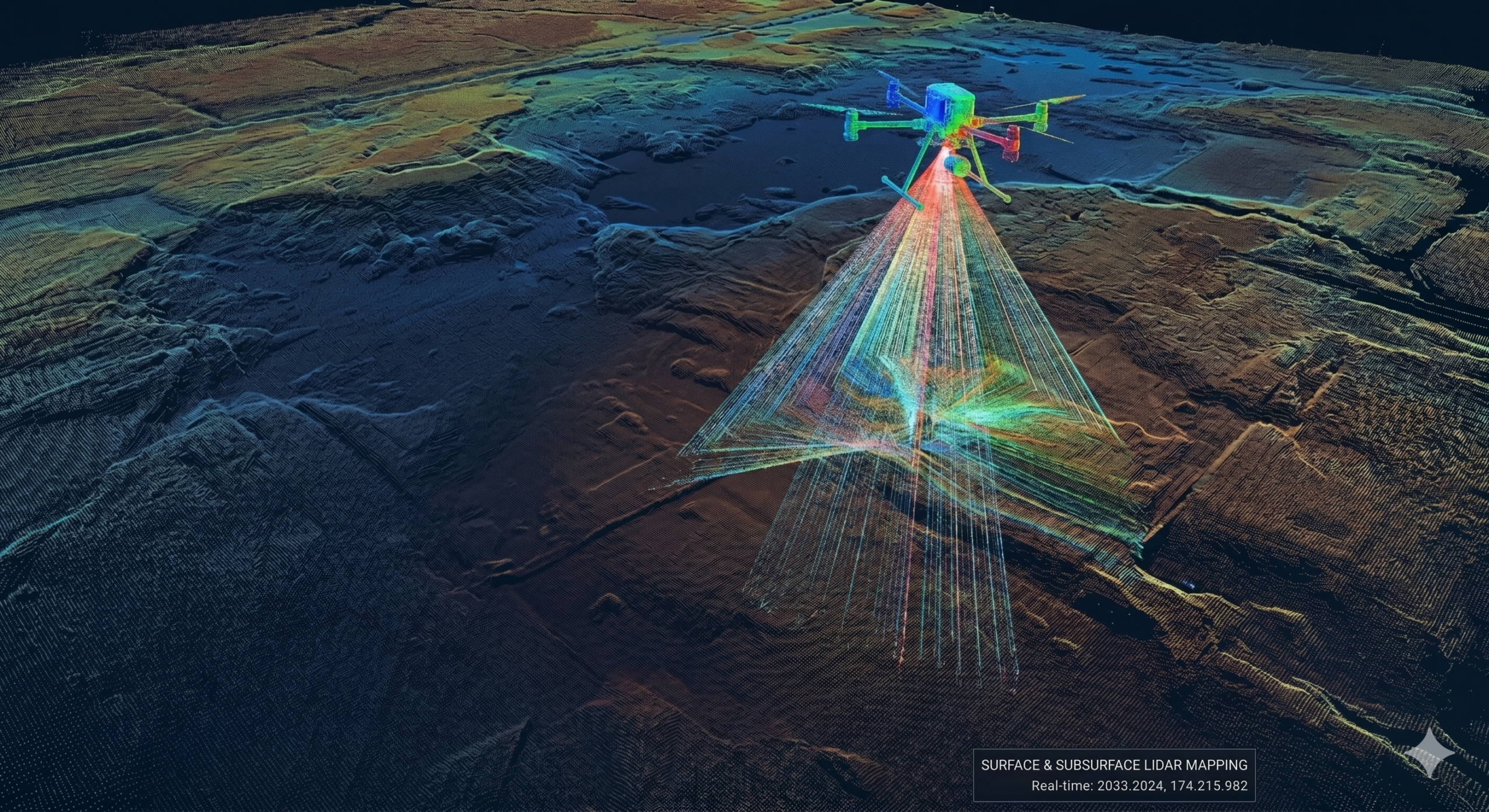
LiDAR, on the other hand, excels where photogrammetry struggles. Because a LiDAR sensor fires millions of laser pulses at multiple angles, many of those pulses pass straight through the gaps between leaves and branches, hitting the actual ground below. This allows us to digitally “strip away” the vegetation and map the true terrain underneath—a process known as generating a Digital Terrain Model (DTM).
The Big Benefits of Drone LiDAR for Scottish Projects
1. Penetrating Dense Canopy and Vegetation
Whether you are surveying a commercial forestry site in Aberdeenshire, a peatland restoration project in the North, or an overgrown development site near Glasgow, vegetation is a barrier. Drone LiDAR pierces through the canopy to reveal ditches, slopes, and structures hidden to the naked eye.
2. Unmatched Speed and Efficiency
Traditional ground surveying crews can take days or weeks to traverse difficult, hazardous, or boggy Scottish terrain. A LiDAR drone can cover hundreds of acres in a single day, drastically reducing project timelines and getting data into your hands faster.
3. Enhanced Safety
Scotland’s landscape can be unforgiving. Steep slopes, quarries, cliffs, and marshlands pose genuine safety risks to ground personnel. Deploying a drone allows our pilots to gather centimeter-accurate data from a safe distance, keeping boots off dangerous ground.
Real-World Applications
Who is using Drone LiDAR in Scotland? The applications span across several core industries:
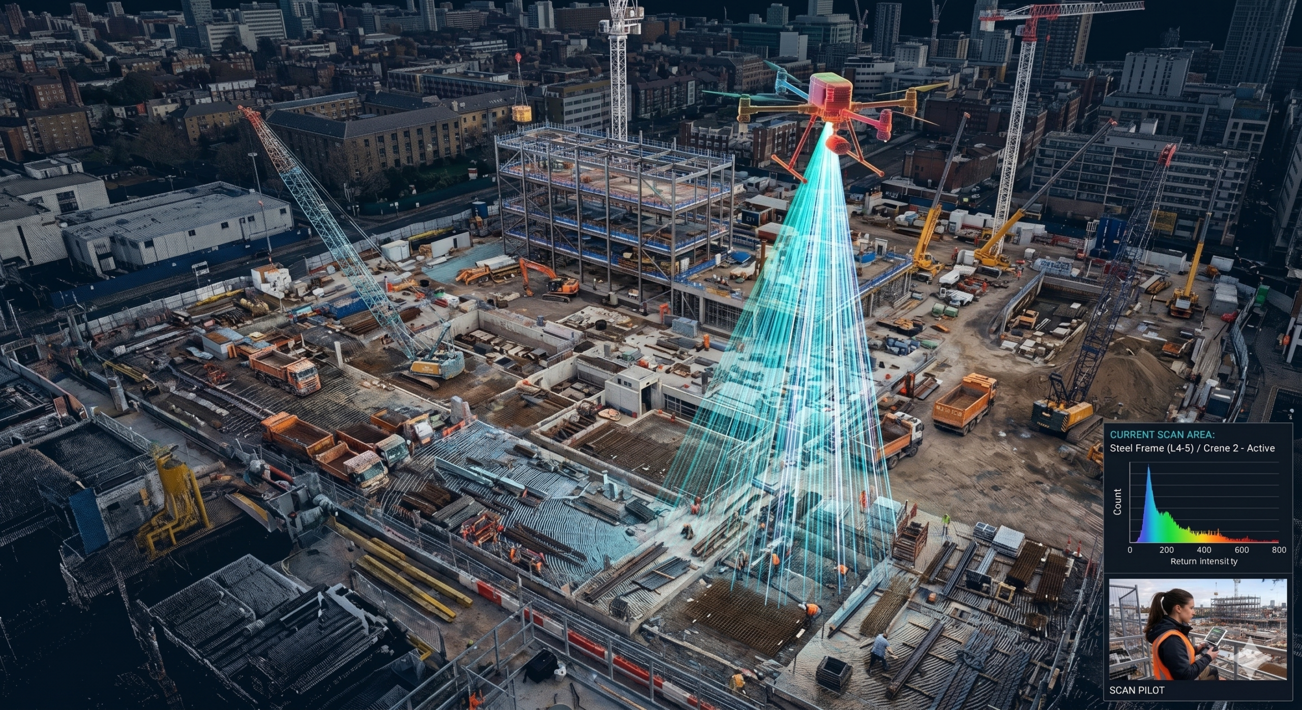
- Construction & Civil Engineering: For accurate earthwork calculations, stockpiling volumes, and initial site leveling plans.
- Forestry Management: To calculate canopy height, tree density, and accurately map forest floors for harvest planning.
- Infrastructure & Asset Management: Inspecting rail corridors, powerlines, and coastal erosion defenses.
- Archaeology & Heritage: Revealing historic structures, old ruins, or historical earthworks hidden beneath centuries of overgrowth.
Elevate Your Next Project with Drone Scotland
At Drone Scotland, we combine state-of-the-art drone and LiDAR technology with expert piloting and data processing. We don’t just deliver a point cloud; we provide actionable insights, precise topographic contours, and comprehensive data formats compatible with your CAD or GIS software.
Ready to see how LiDAR can save time, cut costs, and improve safety on your next project?
For more information contact our team at office@dronescotland.com or (0131) 203 3077