How Drone LiDAR is Revolutionising Surveying in Scotland
When it comes to mapping and surveying, Scotland presents a unique set of challenges. From the dense forestry of the Highlands and overgrown terrain in the Lowlands, to our notoriously …
When it comes to mapping and surveying, Scotland presents a unique set of challenges. From the dense forestry of the Highlands and overgrown terrain in the Lowlands, to our notoriously …

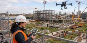
Introduction Drone-mounted LiDAR (Light Detection and Ranging) has revolutionised the way we capture detailed topographic, vegetation, and infrastructure data. The precision and efficiency of LiDAR are unmatched, enabling the rapid …