


Prepping for the shift – a new era at Drone Scotland
At Drone Scotland, standing still has never been an option. Over the past few years, our team has flown hundreds of site surveys, building inspections and utility inspections across some …

At Drone Scotland, standing still has never been an option. Over the past few years, our team has flown hundreds of site surveys, building inspections and utility inspections across some …
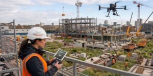
When it comes to mapping and surveying, Scotland presents a unique set of challenges. From the dense forestry of the Highlands and overgrown terrain in the Lowlands, to our notoriously …

Introduction Drone-mounted LiDAR (Light Detection and Ranging) has revolutionised the way we capture detailed topographic, vegetation, and infrastructure data. The precision and efficiency of LiDAR are unmatched, enabling the rapid …
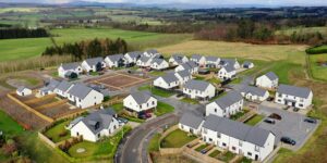
Introduction The construction and housebuilding industries in the United Kingdom are undergoing a profound transformation, driven by the integration of drone technology. With their capacity for rapid data capture, enhanced …

Scotland’s housebuilding sector is transforming through innovation, with industry leaders like Taylor Wimpey embracing new technologies. A key player in this evolution is Drone Scotland, which uses unmanned aerial vehicles to revolutionize how homes are planned, built, and sold.
Drones provide a bird’s-eye view, offering significant benefits:
Planning & Surveys: Drones create detailed site maps, improving the accuracy of initial plans and environmental assessments.
Construction Monitoring: Regular aerial footage tracks progress, helping project managers quickly spot issues and ensure timely delivery.
Marketing & Sales: High-quality drone videos and images showcase new developments and their surroundings, giving potential buyers a unique perspective.
The collaboration between Taylor Wimpey and Drone Scotland demonstrates the power of this technology. Drones streamline operations, enhance safety, and ultimately help create more efficient and appealing new communities. By adopting this technology, the Scottish housing market is becoming smarter and more sustainable.

The construction and property industries are increasingly adopting cutting-edge technologies to improve efficiency, safety, and accuracy. Among these innovations, drones—also known as unmanned aerial vehicles (UAVs)—have emerged as powerful tools …
Most organisations don’t publicly discuss conflict they have on projects. Yet, conflicts are an inherent part of the project lifecycle be it a minor verbal matter or large scale litigation. …

We were recently asked to provide an aerial LiDAR survey of a 25,000m² area of dense forestry. The purpose of the LiDAR survey was to create a digital terrain model, …

Drone Surveys, Aerial surveys, UAS surveys or UAV surveys? Whatever terminology you use, it’s fair to say the use of drones in construction is growing fast. 8 years ago drones …
At Drone Scotland we’ve been working with housebuilders for over 4 years. We’ve flown 100’s of flights across new build housing developments. Housebuilders engage our services from site concept through …
